The Last Days of the Northern Avenue Bridge
I posted a photo of an old railroad diamond to an
Abandoned Railroads group on Facebook. Well, the post got so many "likes" I figured I would take some more photos of the area, which turned into a blog post...
So here is the history of that diamond.

The diamond that started it all
The area of Boston now known at the Searport District was once, well, a
seaport. Lots of industry. Plenty of shipping.
And railroads. Lots of railroads. Railroads before there was land. The New York and New England Railroad ran through the Dorchester mudflats, as they were called, on its way into Boston, terminating close to where the current South Station is located.
Of all the yard trackage that used to fill the Fort Point area, there are only two remnants left in place. One is a semi-active yard track that
goes by the Convention center, with abandoned tracks continuing to the
Design Center. This is the track that runs next to the South Boston Bypass Road. The other remnant is some rusted rails near the old Northern Avenue Bridge.

Seaport area in its heyday
Fan Pier on the left
Northern Avenue Bridge in the center
More New Haven yards in the background
(Photo from internet)
The first track of the diamond has to do with the waterfront end of the yard.
Left in the photograph above (and below) is a stub-end yard. The yard fans out to a set of team tracks - This fan track layout gave this particular area the name Fan Pier. A Federal courthouse now stands on this location.
(Thanks to Paul Cutler on the History of Boston FB group: "The Fan Pier (A.K.A. Pier 1) was mostly for team tracks. A "team track" was a railroad term used when setting out freight cars for customers that didn't have dedicated railroad sidings of their own but still needed boxcar-sized shipments. The customer would load or unload the boxcar with a wagon hauled by a "team" of horses, thus the term. In the above pic, note that the tracks fan out to allow extra paved space between pairs of tracks to allow wagons and later trucks to load or unload the cars.")

A better view of the Fan of Fan pier.
The boxcar next to the barge is the track that is half of our diamond
(Internet photo)
In addition to the fan tracks, another siding followed the water's edge around Fan Pier. I can only assume this track was used to load/unload freight directly from ships into freight cars.
I have not read any history about that area, but in the image above we can not only see a freight car right next to a barge, but the tracks themselves are on piers.
The first track of our diamond is this track, as it went between the dock area to the yards, passing right in front of the Northern Avenue Bridge.
Below is a map snapshot showing our waterfront trackage crossing the bridge trackage (circled in red) For the full map, please follow the link to my friends at WardMaps. Complete map if the Fan Pier area, from 1919

Fan Pier and Northern Ave diamond (upper left)
The second track of the diamond sent freight from the yards, down the center of Northern Avenue itself, across the Northern Ave Bridge, and directly into
downtown Boston.
Built in 1908, the Northern Avenue Bridge is a "Pratt-type through-truss bridge with a rim-bearing center span that swung open to allow for water traffic". It is one of three bridges crossing Boston's Fort Point Channel.
(Once an active shipping channel, each of the three bridges used a different
method to open.) The Northern Avenue Bridge was built to have three
'lanes' - one each for North and South automobile traffic, and a center lane containing a railroad track.
Once over the bridge, this track ran down the center of Atlantic Avenue -
servicing all of the warehouses and businesses on Boston's waterfront.
The railroad continued around Atlantic to Commercial street, finally
crossing the Charles River to connect to B&M Railroad in the North
Station area. This operation is detailed in the book
The Railroad That Came Out At Night
- a great read if you are interested in inner-city railroading.

A sample of the Union Freight Railroad on Atlantic Avenue, and the docks it served, can be seen in
this WardMaps map from 1928.
But time moves on, leaving the heyday of railroading behind. Freight moved to trucks, and the New Haven Railroad was soon no more. The old railyards turned into parking lots, which, in the last 5 years, have given way to office buildings, expensive condos, and a
rebranding of the area as The Seaport District.
The Northern Avenue Bridge itself has succumbed to time as well. It was closed to cars in 1997 due to structural deficiencies, and in 2014 was closed to Pedestrians for the same reason. (1 block away, the
fixed-span Moakley Bridge now carries vehicle traffic over the
Channel.) In 2015 the coast guard ordered the Northern Avenue Bridge to be locked in the open position, never to carry traffic again, Railroad or otherwise. (There was fear the bridge would literally collapse, falling into and blocking navigation of the Channel.)
The diamond that started this blog post, and a short pavement-covered track area, are all that is left of this hub of railroad activity. And even those remnants are living on borrowed time. In 2020 a final design of a
new Northern Avenue bridge (mostly pedestrian-only) bridge was presented, with construction not too far in the future.
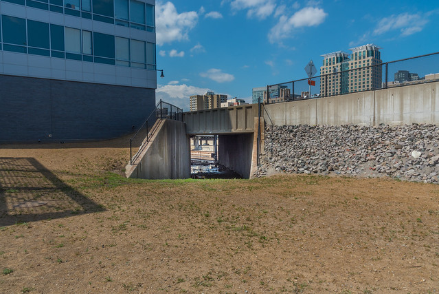
Below are some images of what remains of this once busy junction.

View looking north over the old bridge
Above is your best view. The pavement is old enough you can see
the impressions of the old rails, apparently just paved over rather than
removed. Going from left to right are the tracks that
went from the yard to Fan Pier itself. The tracks going away
from you go over the bridge into Boston.
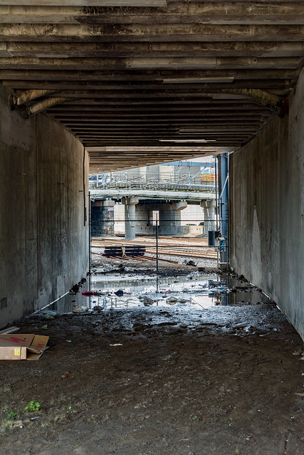
Some additional views

The bridge is to our left
These tracks would continue on and follow the curve of Fan Pier

Close-up of tracks to fan pier.
The rails have become exposed as the asphalt wears away
This is the diamond joint in my original image

A close up of the rails

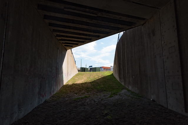
The bridge is to our right
No yard anymore - now a seafood restaurant
The Barking Crab
Grab some lunch if you are railfanning!
 \
\With the bridge at our back, tracks cross the diamond and would have continued down Northern Avenue. As we can see modern development has taken over the old railyards

|
|
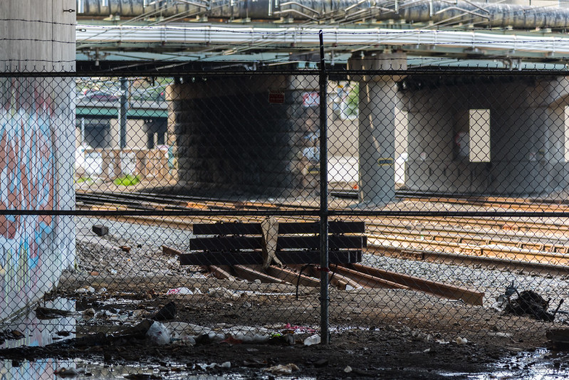
Looking over the bridge Pavement tracks give way to grass-tracks beyond the fence |
Thanks for visiting. Hopefully you've found this interesting,
and learned a bit of Boston history.
If you'd like to 'railfan', you can stop by
Northern Ave and Sleeper Street. Close to South Station (Red Line) and Courthouse Station
(Silver Line bus), as well as plenty of parking in the area.
Restaurants and the harbor walk give you plenty of stuff to do.
If you like to railfan and don't mind walking, these aren't too far
away. (Perhaps future blog posts?)
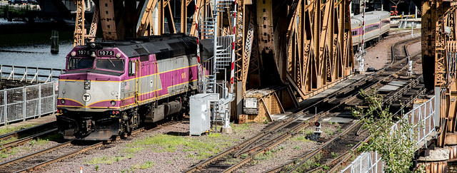
- West Second street - you can see the other rail line, currently re-purposed to test new subway cars
- Rolling Bridge Park - a view of the tracks out of South Station and the Red Line yards
- Broadway Bridge - Overhead view of Cabor yards and MBTA's South Side traffic
- Ink Under park - view of the channel and MBTA/Amtrak southbound traffic. Under the highway, so shady and plenty of seating.

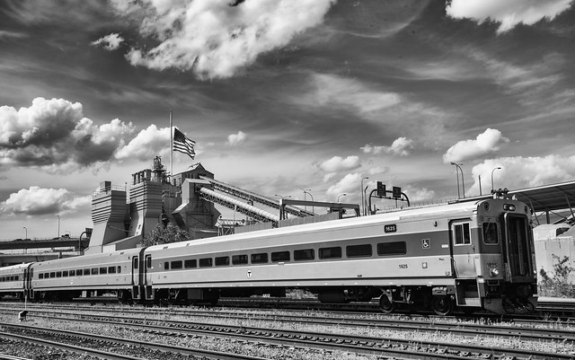
Northern Avenue Bridge, with old tracks, and city skyscrapers in the background
This blog entry wouldn't be complete without giving credit to WardMaps
(at wardmapsgifts.com).
They have scanned in old maps of Boston, and offer them as prints at a
reasonable price. If you live in the Boston area, they have a
physical store just outside of Porter Square. (Boston used to
publish large books of city maps by Ward (Election/representative area),
hence Ward Maps). Over time they have expanded and carry maps of cities all over the world. Please consider visiting and get a railroad or neighborhood print for your home!
See more of my photography on my Flickr pages