Showing posts with label Railroad. Show all posts

Thursday, July 16, 2020

Fan Pier Remnants

The Last Days of the Northern Avenue Bridge


I posted a photo of an old railroad diamond to an Abandoned Railroads group on Facebook.    Well, the post got so many "likes" I figured I would take some more photos of the area, which turned into a blog post...     So here is the history of that diamond.


The diamond that started it all


The area of Boston now known at the Searport District was once, well, a seaport.   Lots of industry.  Plenty of shipping.   And railroads.   Lots of railroads.   Railroads before there was land.  The New York and New England Railroad ran through the Dorchester mudflats, as they were called,  on its way into Boston, terminating close to where the current South Station is located.   

Of all the yard trackage that used to fill the Fort Point area, there are only two remnants left in place.  One is a semi-active yard track that goes by the Convention center, with abandoned tracks continuing to the Design Center.  This is the track that runs next to the South Boston Bypass Road.   The other remnant is some rusted rails near the old Northern Avenue Bridge.   


Seaport area in its heyday
Fan Pier on the left
Northern Avenue Bridge in the center
More New Haven yards in the background
(Photo from internet)

The first track of the diamond has to do with the waterfront end of the yard.

Left in the photograph above (and below) is a stub-end yard.   The yard fans out to a set of team tracks -  This fan track layout gave this particular area the name Fan Pier.  A Federal courthouse now stands on this location. 

(Thanks to Paul Cutler on the History of Boston FB group:   "The Fan Pier (A.K.A. Pier 1) was mostly for team tracks. A "team track" was a railroad term used when setting out freight cars for customers that didn't have dedicated railroad sidings of their own but still needed boxcar-sized shipments. The customer would load or unload the boxcar with a wagon hauled by a "team" of horses, thus the term. In the above pic, note that the tracks fan out to allow extra paved space between pairs of tracks to allow wagons and later trucks to load or unload the cars.")

A better view of the Fan of Fan pier.
The boxcar next to the barge  is the track that is half of our diamond
(Internet photo)


In addition to the fan tracks, another siding followed the water's edge around Fan Pier.  I can only assume this track was used to load/unload freight directly from ships into freight cars.   I have not read any history about that area, but in the image above we can not only see a freight car right next to a barge, but the tracks themselves are on piers.     

The first track of our diamond is this track, as it went between the dock area to the yards, passing right in front of the Northern Avenue Bridge.

Below is a map snapshot showing our waterfront trackage crossing the bridge trackage (circled in red)  For the full map, please follow the link to my friends at WardMaps.   Complete map if the Fan Pier area, from 1919


Fan Pier and Northern Ave diamond (upper left)


The second track of the diamond sent freight from the yards, down the center of Northern Avenue itself, across the Northern Ave Bridge, and directly into downtown Boston.   

Built in 1908, the Northern Avenue Bridge is a "Pratt-type through-truss bridge with a rim-bearing center span that swung open to allow for water traffic".  It is one of three bridges crossing Boston's Fort Point Channel.    (Once an active shipping channel, each of the three bridges used a different method to open.)  The Northern Avenue Bridge was built to have three 'lanes' - one each for North and South automobile traffic, and a center lane containing a railroad track.    

Once over the bridge, this track ran down the center of Atlantic Avenue - servicing all of the warehouses and businesses on Boston's waterfront.   The railroad continued around Atlantic to Commercial street, finally crossing the Charles River to connect to B&M Railroad in the North Station area.   This operation is detailed in the book The Railroad That Came Out At Night - a great read if you are interested in inner-city railroading.   


A sample of the Union Freight Railroad on Atlantic Avenue, and the docks it served, can be seen in this WardMaps map from 1928.  


But time moves on, leaving the heyday of railroading behind.  Freight moved to trucks, and the New Haven Railroad was soon no more.  The old railyards turned into parking lots, which, in the last 5 years, have given way to office buildings, expensive condos, and a rebranding of the area as The Seaport District.     

The Northern Avenue Bridge itself has succumbed to time as well.  It was closed to cars in 1997 due to structural deficiencies, and in 2014 was closed to Pedestrians for the same reason.  (1 block away, the fixed-span  Moakley Bridge now carries vehicle traffic over the Channel.)   In 2015 the coast guard ordered the Northern Avenue Bridge to be locked in the open position, never to carry traffic again, Railroad or otherwise.  (There was fear the bridge would literally collapse, falling into and blocking navigation of the Channel.)

The diamond that started this blog post, and a short pavement-covered track area, are all that is left of this hub of railroad activity.  And even those remnants are living on borrowed time.   In 2020 a final design of a new Northern Avenue bridge (mostly pedestrian-only) bridge was presented, with construction not too far in the future.   

Below are some images of what remains of this once busy junction.


Last Train to Boston
View looking north over the old bridge


Above is your best view.   The pavement is old enough you can see the impressions of the old rails, apparently just paved over rather than removed.     Going from left to right are the tracks that went from the yard to Fan Pier itself.    The tracks going away from you go over the bridge into Boston.

Some additional views

The bridge is to our left
These tracks would continue on and follow the curve of Fan Pier


Close-up of tracks to fan pier.
The rails have become exposed as the asphalt wears away
This is the diamond joint in my original image


A close up of the rails


The bridge is to our right
No yard anymore - now a seafood restaurant The Barking Crab
Grab some lunch if you are railfanning!


\
With the bridge at our back, tracks cross the diamond and would have continued down Northern Avenue.  As we can see modern development has taken over the old railyards


Looking over the bridge
Pavement tracks give way to grass-tracks beyond the fence


Thanks for visiting.    Hopefully you've found this interesting, and learned a bit of Boston history.

If you'd like to 'railfan',  you can stop by Northern Ave and Sleeper Street.   Close to South Station (Red Line) and Courthouse Station (Silver Line bus), as well as plenty of parking in the area.   Restaurants and the harbor walk give you plenty of stuff to do.    

If you like to railfan and don't mind walking, these aren't too far away.   (Perhaps future blog posts?)
  • West Second street - you can see the other rail line, currently re-purposed to test new subway cars
  • Rolling Bridge Park - a view of the tracks out of South Station and the Red Line yards
  • Broadway Bridge - Overhead view of Cabor yards and MBTA's South Side traffic
  • Ink Under park - view of the channel and MBTA/Amtrak southbound traffic.   Under the highway, so shady and plenty of seating.


Stately Past
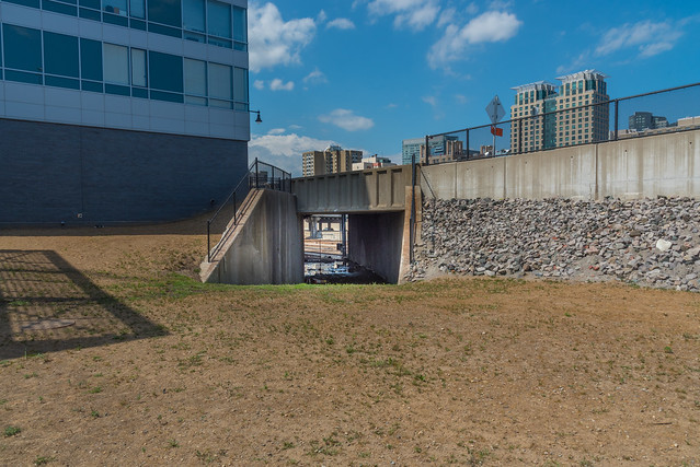
Northern Avenue Bridge, with old tracks, and city skyscrapers in the background


This blog entry wouldn't be complete without giving credit to WardMaps (at wardmapsgifts.com).  They have scanned in old maps of Boston, and offer them as prints at a reasonable price.   If you live in the Boston area, they have a physical store just outside of Porter Square.    (Boston used to publish large books of city maps by Ward (Election/representative area), hence Ward Maps).  Over time they have expanded and carry maps of cities all over the world.  Please consider visiting and get a railroad or neighborhood print for your home!


See more of my photography on my Flickr pages


Monday, September 4, 2017

Railfanning: Lancaster Station

Heading north from Strasburg I made a quick stop at Lancaster train station in Lancaster, PA.  Built by the Pennsvlania railroad in 1929, back in the days when even the most remote stations wee built to be impressive.

The station underwent a major restoration, completed in 2013.   The inside of the station looks amazing, while the platforms are a mix of nostalgia and needing a bit of TLC.


Building exterior. 


Renovated lobby
Past the doors is an over-track waiting room

The way up
Stairs from the waiting room to the platform


Waiting Area
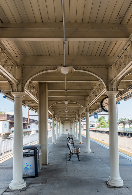
Older style platform shelter


Rivets and lattice steel.    Definitely the original shelter


It looks like the station used to have at least 8 tracks through it - almost hard to imagine a smaller city having this large a station.    The station is now down to 4 tracks - two for passenger service and 2 for freight service.


Tracks heading West.  You can see the empty space where additional tracks once were.  Also notice fencing has reduced the length of the platforms - smaller trains stopping here these days. While the right (Passenger side) is open, the left side (off camera) has a fence keeping passengers away from the freight bypass (can see more in photos below)


Shot of the above track waiting room and stairs to the platforms.
Elevators have been added opposite the stairs (brick work behind the cab car)
Oh, and the Philadelphia bound train arrives.


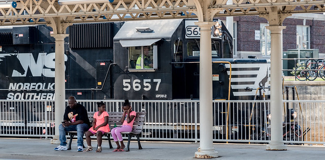
I was there on a Saturday morning, and there wasn't much freight action.  Just saw two freight trains in my hour there.


This train never came through the station - just backed to the switch and went back East


This train did come through on the bypass track


Train!
This young lady didn't appreciate the noise

Train?   What train? This woman barely noticed


The only predictable traffic are the Philadelphia-Harrisburg trains - Amtrak's keystone service.  If you have the Amtrak smartphone app you can tell when the next train in either direction will arrive.


Westbound Keystone train departs Lancaster station

I had no problem taking photographs in the station, and was able to get to the platform without needing a ticket.  So as long as you are responsible, you should have no problem taking photographs at the station.


Video of the freight passing through the station


Happy railfanning!!   Please add a comment if you get to or have been to Lancaster station

9:40

See more photographs on my Flickr pages.


Rail Destination: Strasburg, PA

This year I decided to extend my PA trip to Allentown for DCI East to include a side trip to the Strasburg Railroad.

The Strasburg railroad is the oldest continuously operated railroad charter in the US.   Today' it's a tourist railroad running several steam trains per day on a short 45 minute excursion trip (an out and back ride - 4.5 miles).   The locomotives and various passenger cars are all historic equipment, restored to running condition.   Trains run hourly, and there are plenty of things to do on site for the kids.   There are occasional special trains, like a Wine and Cheese special, or a Day Out with Thomas.  (They also do limited freight service....)  The rail cars range from an open air coach (great for photos!) to an air conditioned parlor car.

Across the street is the Railroad Museum of Pennsylvania, a large collection of restored equipment, cars and locomotives, preserved in an indoor climate controlled environment.    It's easy to take in both attractions on the same day (at a discounted price).

The trip is through the beautiful Lancaster county countryside, making the train ride a great way to see the area.  You can see some of my on-train photos here.

If you're ever in the Lancaster area, a trip to Strasburg RR needs to make it on your agenda!


Down the tracks
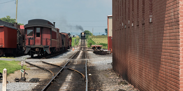
The previous excursion train approaches the station


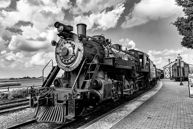
#90
Train arriving at the station.  
Steam always look great in Black & White - the clouds were an added bonus


Runaround
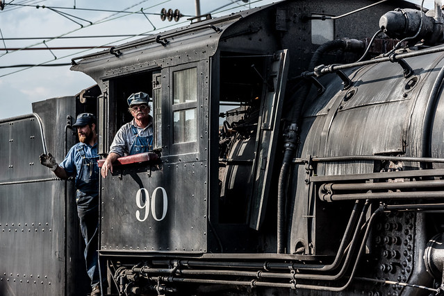
Locomotive #90 runs around our train to pull us back to the station
Ironically, the Steam excursion turns around at the Amtrak electrified Harrisburg line.


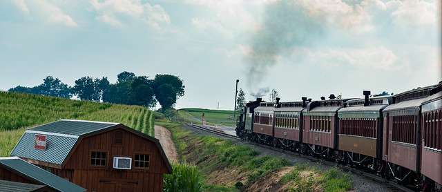
'round the bend
Our train as we go around a bend.   Farmland runs on either side of us.


An open coach.  
Not the most luxurious, but no windows makes better photograph opportunities


One last Steam photograph


 The RR museum of PA - half the collection, as seen from a catwalk.

You can find more photos from my Lancaster trip on my Flickr pages.


Sunday, August 13, 2017

Railfanning: Macungie, Pennsylvania

When I travel for any reason I always do a little research to see if there are any good railfanning spots in the area.   You never know if you're near a hotspot of how much rail traffic might be in the area.

So I'm planning on our annual trip to Allentown for the DCI East Coast finals.   Having driven around Allentown for Drum Corps, I did notice lots of tracks in the area, but had no clue what traffic went where, or where some good spots are.   Plus, not everyone on the trip is a railroad fan.   (OK, none of them are).   But I didn't want them to stop me.

The park

Searching the internet I found a place in Macungie, PA - a park dedicated for railfanning!  I found an article that details the planting of the  Flower Park adjacent to the tracks,  but only this fellow railfan's article on the construction of the station-like pavilion that sits next to the flower park and the tracks.

The only remnant of the original train station is a crumbling curb which was the station platform back in the day...   However, the flower park is quite nice, and worth walking through while waiting for trains.  Even during my August visit the park was in full bloom - the park is certainly well cared for.

Railfan Park
Entrance to the flower park off of the main street.   
Tracks are behind the white fence, and the pavilion is off photo to the right.

Macungie Station
Macungie station/pavilion.   
Flower park on the left.  Tracks on the right.  Grade crossing near the van in o the left.

As a railfan, it was nice to see a place for us.   Railfanning is often pulling your car to the side of the road or some other out of the way place near tracks where you can see trains and not trespass on railroad or private property.   Here the pavilion is adjacent to parking, provides shelter from the sun and rain, and has plenty of seating!    When I was there Saturday I also ran into some locals there to train spot as well - everyone was very friendly!

But to the trains...

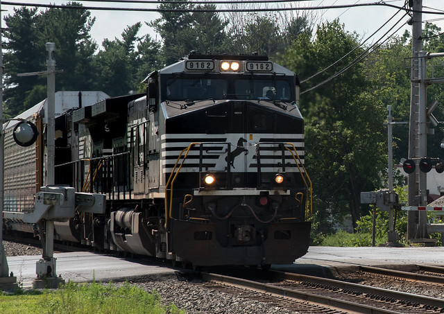
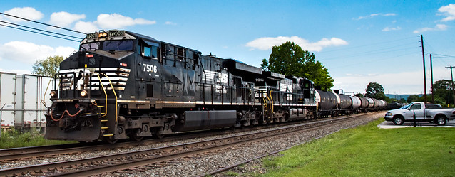
9162
An Eastbound autorack train at the crossing


The action was pretty good at the location.  I was there on a Friday afternoon and Saturday late morning, and saw many trains bother times.  Flow isn't consistent - 4 trains in one hour, then nothing the next hour sometimes.    There were a lot of trains Saturday morning as (we assumed) they were clearing the yard and sending all the trains out...

7506 returns
A Westbound mixed freight.   I'll see this same locomotive again the next day.


If you don't have a scanner, it's still easy to spot when trains are approaching.  Eastbound trains go over 2 other grade crossings before reaching Macungie, so if you keep your ears open you can hear the whistle for those crossings and be ready.

Westbound trains have no grade crossings, but looking west there is an approach-list signal, so when that turns green something is most likely on it's way.   There's also a good sight line both east west, so you can just keep your eyes open.    but trains come through at a good clip, so once you can see a train, it'll be on you within 30-odd seconds.


Macungie East Macungie West
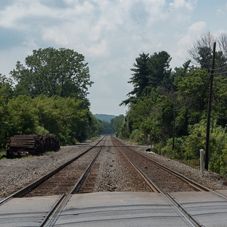
Looking East (left) and West (right) from Macungie station


If you're ever in the area, I encourage you to visit Macungie.   The railfan park is a great resource.  There's a convenience store across the street.  If you're there on the weekend there may be other events going on in the town (there was a giant flea market and antique car show the weekend I was there).  And, if you're lucky, you'll run into some other railfans there!

Hi
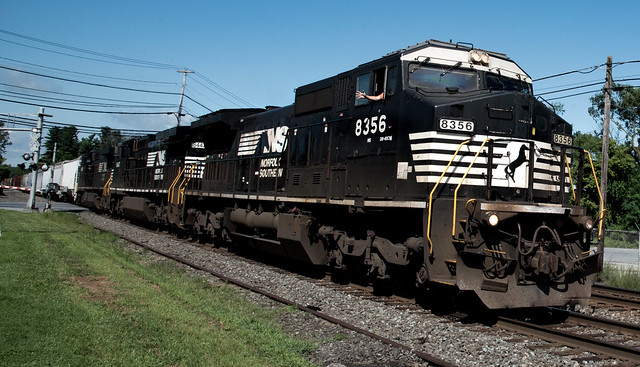
Some young kids (with Mom) showed up to railfan, and were rewarded with a wave by the engineer.


Video

While snapping photos with the SLR, I propped up the iPhone for some video.    A compendium is below.


Happy railroading!

More of my photos from Macungie can be found here.

Railfan information about Macungie.


Sunday, November 20, 2016

Railfanning: Boston, Boston Herald site

You don't always have to travel to railfan - sometimes railfanning right in your back yard can provide you with new experiences as well.  

On this occasion I was at the old Boston Herald site in the South End of Boston.   The area, once bay and swampland, was filled with brownstone like homes for around 100 years.   In the 1950's the whole area was bulldozed as part of Urban Renewal and zoned light industrial.   At this location Boston Herald set up shop for both reporters and printing presses.   This was still the era of rail deliveries, so a rail spur for paper delivery was built as part of the complex.

Former Boston Herald site from 2005.  No deliveries by rail any more but spur was still in place.


Loading Docks at the end of the spur (2005)


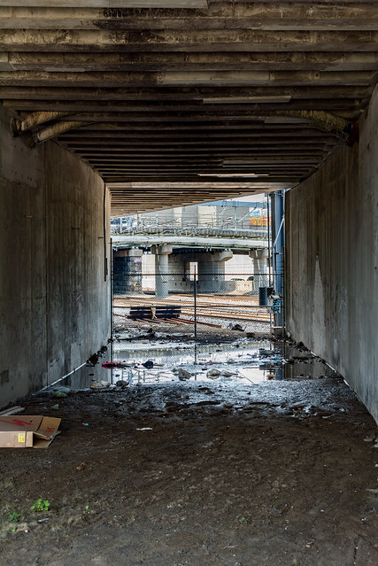
The area is located at Herald and Albany streets.  The spur came off the North East Corridor (NEC), under Herald street, then onto the Herald property.   (Most folks driving on Herald street have no idea there is a bridge over this spur).

The Herald has moved away, and the location is being redeveloped as housing with ground floor commercial.   The railspur area is currently parking lot and open grass (dirt).

In the below snapshot from Google Earth view (2015) you can still see the siding coming off the NEC, and the rail spur going under Herald street.   Construction of the new housing (Ink Block) is well under way at this point.

Spur coming off the NEC (upper left) and spur portal under Herald st (lower right)

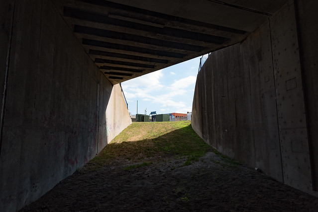
The spur looks quite different now.  At the moment the area seems unused - some parking.  and a small hillock attempting to obscure the portal.   I have no clue what plans are for this corner of the site.


Herald Siding - 1
Portal today (2016)

but now that construction is done, the portal is accessible.


Herald Siding - 2
Looking in from the portal entrance


There's some trash in the underpass.   Not sure if it's construction leftovers or trash form people hanging out there.   It had not rained in days, but the area was still muddy from showers the previous week.   Some serious drainage issues.   I sank instantly if I tried to get closer, so I had to railfan from mid underpass.

Herald Siding - 5
Mid portal looking back. 

Looking back to the parking lot it's evident how much landfill has been added.   The spur came in at NEC level and actually sloped down to the siding.

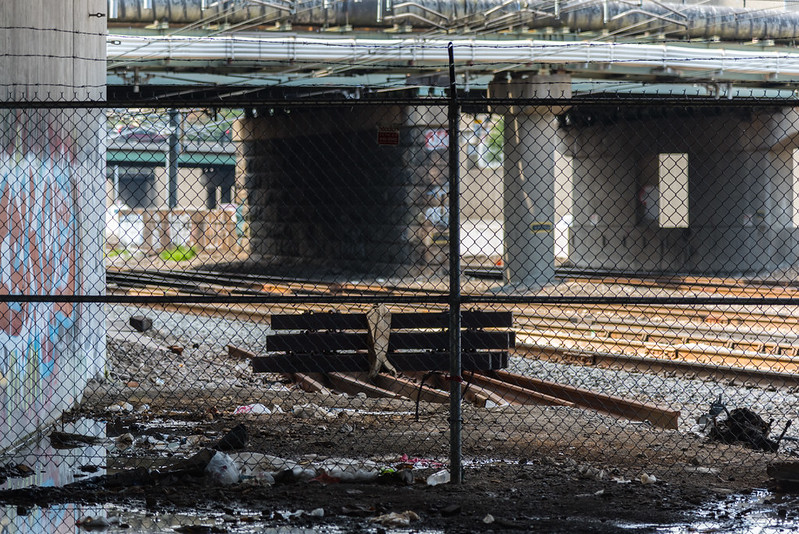
Even mid tunnel you get a great view of the NEC.  The siding has been removed form the NEC main line.  Looks like the switch body/frog was left on the side of the mainline.  You can see the mud I'm standing on was added, bringing the tunnel floor up around 6 inches to begin with.

A fence is in place to keep all safe and prevent anyone wandering onto the NEC tracks.   While there is no high speed service at this location, there is a lot of train activity - several trains an hour during rush hour.    For those in the know, this is between the main curve out of South Station and Cove interlocking.     From the view below, Back Bay station is to our left and South Station is to our right.


Herald Siding - 4
Looking out of the tunnel onto the NEC tracks.

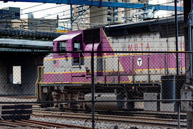
Both Amtrak and the MBTA use these tracks.  The tracks closest to us are for southbound service, including the NEC to New York.    The tracks furthest from us (on the other side of the stone abutment) go west towards Framingham, Worcester and (Amtrak) to Albany and points west.


Herald Siding - 5
Eastbound MBTA train on the Framingham/Worcester line

Herald Siding - 6
Eastbound MBTA train on the NEC line.

When trains go by on the closest track, you really feel like you're close to the NEC!

At this point there are no 'no trespassing' signs to the portal.   it seems fully accessible to the public.  The few people around didn't seem to care I went exploring.  I visited mid-day, so there were no 'undesirables' hanging out here.   It is a parking lot/delivery ware for a Whole Foods supermarket, so the owners do have an interest in keeping the area safe.

Happy railfanning.


Herald Siding - 7
Train on the way to back Bay station.


See all my railroad images on my Flickr Railroad album.